 |
|
Archway - Tower Bank |
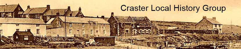
Craster HarbourFishermen have been drawing up their cobles onto the foreshore between Little and Muckle Carrs since time immemorial. The harbour was constructed by the Craster family during the decade before the beginning of WW1 and dedicated to the memory of Captain John Charles Pulleine Craster, who was killed in the Tibetan expedition of 1904. The following account was drawn up in October 1897 as a projection for the income that might accrue if a harbour were to be constructed.
|
|

The harbour project was actually settled upon in 1904 and, in that year, Mr J Watt Sandeman, drew up the plans of the harbour shown on the above plan. Formal approval from the Board of Trade was sought in the autumn of 1904, this was given in 1905. Excavation of rock for the new harbour began in October of that year and in July 1906 the first concrete was poured for the north pier. This pier was finished in September, 1907 and in December the south pier was begun.
|

Writing in 1908, Mr Craster expected the second pier to be finished in October of that year. However, the construction took longer than expected and writing in August 1909 he expressed the hope that it would be finished in the spring of 1909. This expectation was subsequently extended to the summer of 1909.
The limestone bins and the aerial ropeway intended to service them, were not part of the original plans, but were a later embellishment. A plan showing the route of the ropeway is part of the County Collection (NRO 5393/95).
The plan shows the location of the bins at the end of the south pier and the route of the aerial ropeway through the village, but not the sites of pylons. A note on the plans says the ropeway is to be at a height of 75 ft above High Water of Ordinary Spring Tides (HWOST) across the harbour to be clear of ships masts.
The Board of Trade received the plans on July 10th 1911 and permission for the construction to take place was given on February 29th 1912. This permission was granted for a period of three years during which the structures had to be built. Permission expired at the end of this time –February 29th 1915.
An article in The Times, March 20th, 1913, referred to the construction of the bins and ropeway in the future tense, suggesting that work was either at an early stage or yet to be started.
To find out more about how the harbour was constructed, follow this link.
The Harbour After Construction
The following three photographs give a fascinating insight into the working of the harbour C1910, after the completion of the south pier, but before the addition of the limestone storage bins at the end of the same pier.
The first photograph shows a boat leaving the harbour and one in the process of coming alongside another. The second shows them alongside and gives a view of the two stone boats on the north pier. The third shows how busy the day was, with another boat about to enter the harbour and three 'herring' girls in the bottom right enjoying the photography session.
|

|

|

The "Ports & Harbours of Northumberland", by Stafford Linsley gives a detailed and most interesting account of the early days of the harbour. Published in July 2005 (ISBN: 9780752428925)
Activity in the Harbour, 1908 to 1938
The harbour account book, with annual accounts from 1908 to 1938, which is part of the County Collection at Woodhorn, is an invaluable source of information about the activity in the harbour. Extracts from this book have been transcribed and can be downloaded from here. Woodhorn also has copies of the annual financial returns submitted to Northumberland County Council by the Harbour Company (Q/R/UA210-229), which offer a summary of the annual accounts.
The spreadsheet was written in Open Office, which can be downloaded free of charge from Open Office.
Data from the account book has been used to create the following bar charts that show the activity in Craster Harbour during this period. The accounting period used in the book began on April 1st and ended on March 31st; the dates in the charts refer to the end of the accounting period. Therefore, taking the figures for 1916 as an example, the activity recorded took place from April 1st 1915 and ended on March 31st 1916.
The account book has nothing to say of course about any product that was transported by road.
The first chart shows the quantity of stone shipped from the harbour during this time. The accounts suggest that export of stone by sea took place in three phases. During the period 1910 to 1917, exports rose to a peak in 1914 and tailed off during the war. Activity appears to have resumed briefly in 1921/22 and then the business took off again in the 1930's. Shipments throughout the whole period totalled 114,030 tons. (Note; the Total in 1933 is lower than it should be as precise figures were only given for the first half of the year.)
 |
The accounts for the landing of herring, white fish and shellfish are not kept in a consistent way during the period covered by the account book. This has implications for the transcribed records, but the qualifications to the data that are necessary, which do not significantly affect the general picture, are not covered here, but they are in the transcription that can be downloaded.
A more detailed look at the accounts reveals that herring was landed in Craster between, and including, the months of May and September. Given the accounting period explained above, the bar chart shows the herring landed in one year as being landed in the following year! Taking 1916 again as an example, the 163 barrels of herring were actually landed between May and September of 1915.
The chart for herring landed shows significant change over the period. A peak in 1910 is followed by a marked decline in the period before and during WW1. It is perhaps no coincidence that the low of 1916 took place after the German Navy's attacks along the east coast (e.g. on Scarborough in December 1914) and in the period of great tension in the North Sea, which came to a head in the battle of the Dogger Bank in January 1915 and continued until the battle of Jutland May 31st/June 1st 1916. The following twenty years shows landings to be variable, rising to their highest levels in the late 20's, but general activity significantly below the pre-war level, particularly during the last five years before the account book finishes.
 |
The landing of white fish shows cyclical change during the period, rising from a low in 1913 during WW1, a peak in 1922, followed by a decline and then a revival at a lower level in 1926/27. Activity in the 30's was more consistent and sustained until the end of the account book in 1938.
 |
In the run up to WW1 the landing of crab and lobster was typically at a sustained high level. From 1915 activity was generally lower, with isolated highs in 1923 and 1928. In the 30's the annual catch was typically at a new lower level.
 |
The harbour accounts show a surprising and perhaps unexpected pattern of activity in the export of salt herring. It is possible that this trade was rather bigger than shown in the harbour accounts, but was carried out by road. There is no other data currently available to improve our understanding of this aspect of Craster's trade.
 |
 |
Home Programme Membership Archive War Memorials History Walk Miscellanea Links Contact Us