 |
Maps of Craster - 1892
|
"Reproduced from the 1897 Ordnance Survey map with the kind permission of Ordnance Survey" |
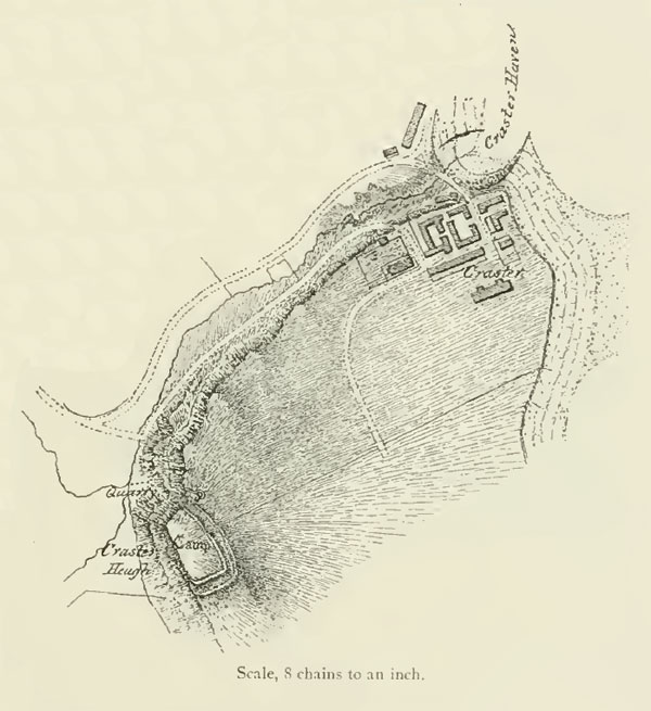
Reproduced from 1892 History of Northumberland, Ed Bateson.
Note: Although the book in which this map appears is dated 1892, a footnote says, '...some years ago, when Mr. MacLauchlan made the plan which is here reproduced.' This tells us that the map pre-dates the book. This may, or may not, be significant for the process of dating the construction of Craster.
Home Programme Membership Archive War Memorials Craster Walk Miscellanea Links Contact Us